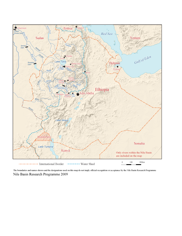
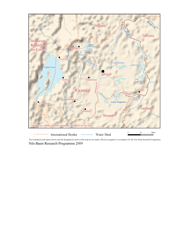
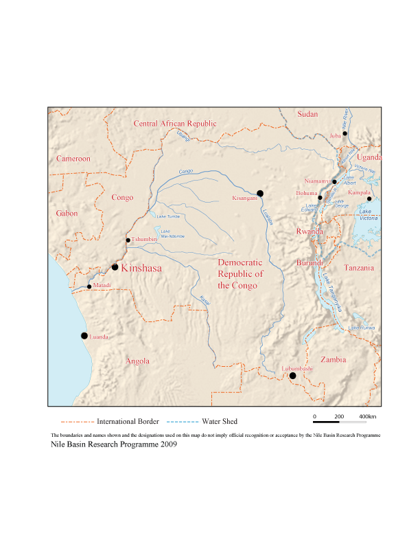
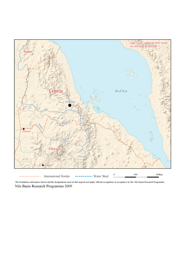
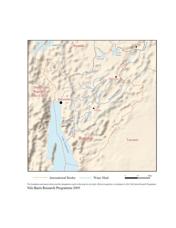
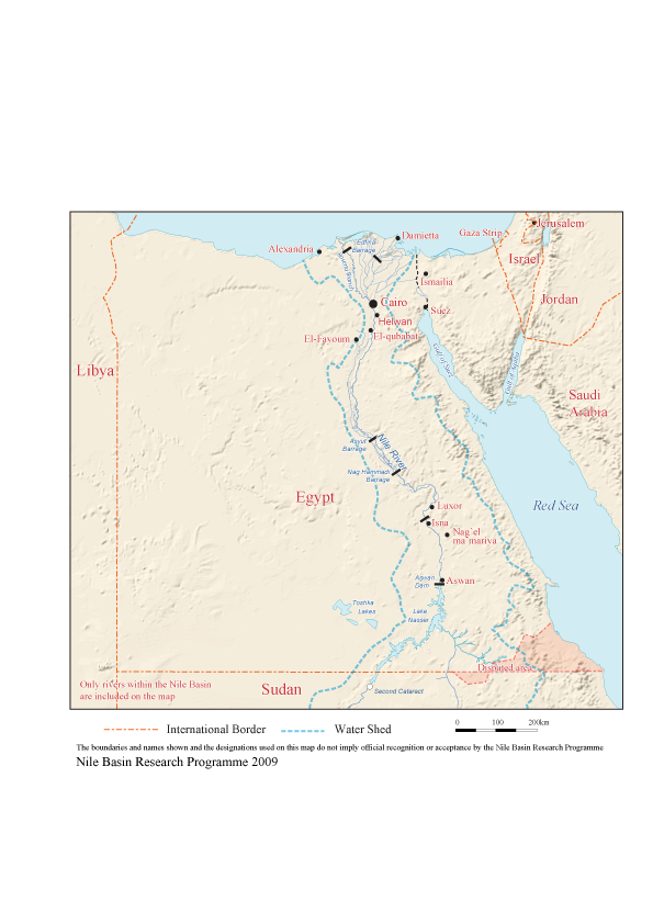
Maps of the Nile Basin

Hovedinnhold
To the right is a list of maps of Nile Basin countries produced by Nile Basin Research Programme and Department of Geography, University of Bergen, 2009.
Please contact us on nile@uib.no with any comments you may have.
List of map resources for the Nile Basin
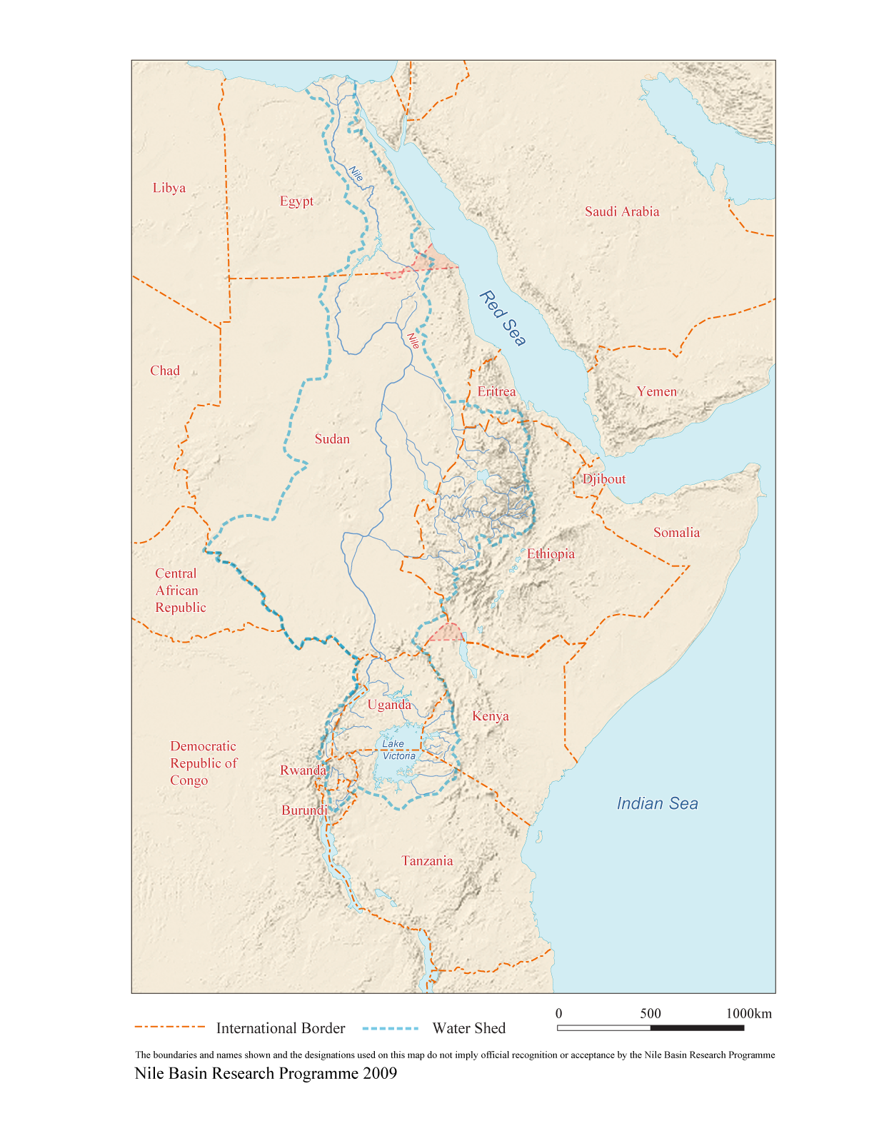
Tributaries and sub-catchments of the Nile River Basin
This map gives an overview of the extent of the Nile River Basin. The site also provides an interactive service where the user can choose several layers such as major or smaller sub-basins within the Nile Basin, cities, names of rivers etc. However, national boundaries are not provided and some rivers look faint because the background is a satellite image. Regardless, it is a helpful tool for familiarising oneself with the Nile and extent of its water resources.
The Nile Basin Map from USDA
This is a good map for one to appreciate the extent of the Nile Basin. However the small font presents difficulties in reading some of the names. National boundaries are not included in the map. In addition to this map there are two additional maps, one showing the equatorial lakes region and the other showing the sketch of the Nile basin including annual rainfall data.
The Nile Basin Map from the Nile Basin Initiative website
This map shows the extent of the Nile River Basin and contains relevant information such as location of some of the major dams including their names. The font is clear and it is easy to read names of the major rivers shown. However, like many maps of the Nile Basin, national boundaries are not included.
The Map of Africa from maps.com
This map produces a fairly good amount of detail. It is colourful and provides details on many parameters. However, the viewing space is small. You can zoom in to get much clearer details but this reduces the extent of the area which you can view at a single time. However, the site provides the ability to buy these maps and explains their originality and so much more.
Equatorial lakes region map
This map from the United Nations Environmental Program (UNEP) shows the water resources of the equatorial lakes region limited to the Nile Basin. Even though some tributaries to Lake Victoria are not named i.e., those from Tanzania and Kenya, the map provides overview of what water resources the Nile River stems from.
Kagera Map
This map of Kagera Basin from the Food and Agriculture Organisation (FAO) is available in PDF format with high resolution. The map has an insert showing the Nile Basin map with the Kagera sub-basin clearly highlighted. Because of the good resolution of the map, you can zoom in for detail on any particular area. However, the rivers are not labelled and as such would be most useful to those who are already familiar with the area
World Resources Institute – Earth Trends: Water Resources and Freshwater ecosystems
From this page you can choose various watersheds around the world and get additional information for each watershed. There are two maps from the Nile River basin. The first shows the whole basin while the second covers the Lake Victoria sub-basin. However, most of the rivers are not labelled so that it is most useful to those who are familiar with the territory.
Guide to country maps available on the Internet
The University of Texas maps
The site provides country maps at various resolutions and file sizes for all the countries in Africa. Maps for Uganda have very good resolution and much more detail. File sizes for these maps are bigger than the rest of Nile countries. Other maps have fair to poor resolution and do not provide much detail.
Unimaps
Provides country maps showing perennial rivers, principle roads etc.
United Nations Cartographic Section website
Provides country maps for all the Nile Basin countries with the exception of Ethiopia and Eritrea. Ethiopia and Eritrea are contained in the map of the Horn of Africa. The maps are generally of good quality.
Maps of the Nile Basin Countries from Nationsonline website
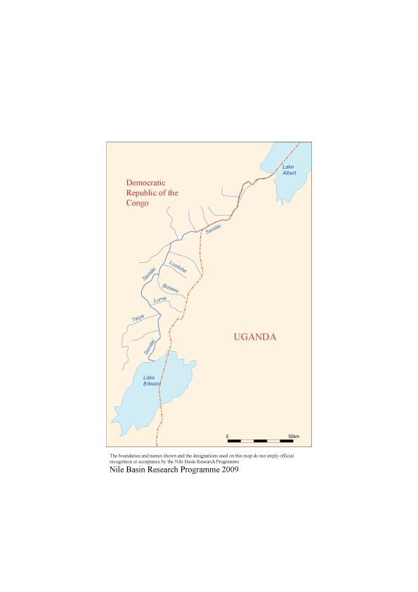
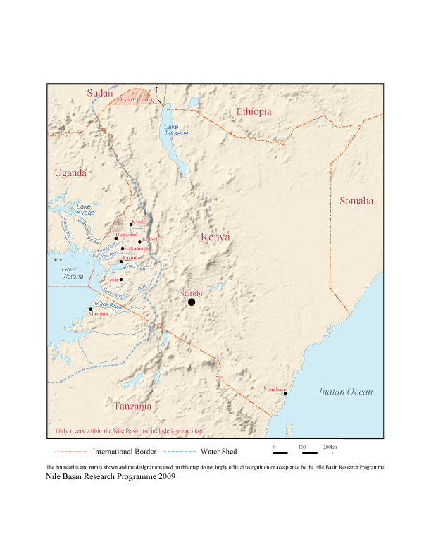
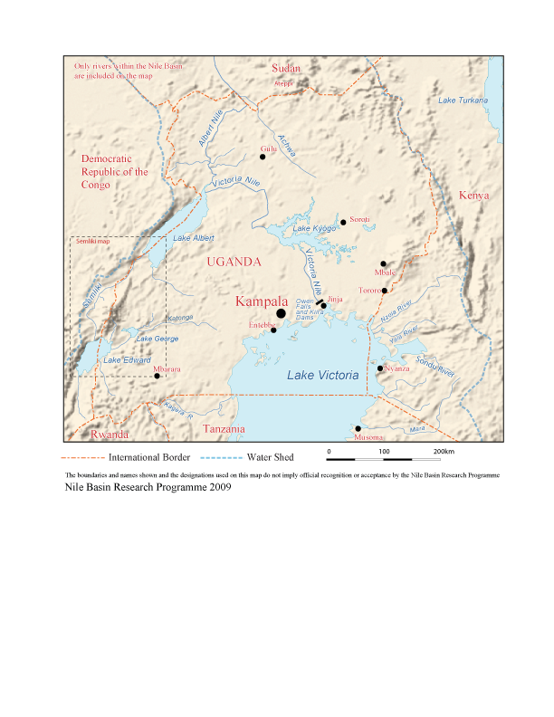
The site has colourful maps for Burundi, DRC, Egypt, Sudan and Rwanda. The maps feature rivers, towns and communication links. For hydrological uses, note that some maps lack important rivers or their names: i.e., Semliki River is not shown on the DRC map. For Kenya, rivers that pour water into Lake Victoria are not named, and for Tanzania, Lake Victoria’s tributaries are not displayed on the maps. However, the site contains much information that may be helpful to the user i.e. country profiles, various types of maps, and important links that provide information on the countries’ economy, statistics, products, destination and tour guides, environment and nature, history and communications.
Maps from geology.com
This site provides access to maps of all the African countries. The maps are not very detailed but show some of the major roads, cities, bodies of water for each country.
Atlases and maps of Africa from Intute website
This site has gathered links to other websites that contain maps. Hence this could be a useful site by easing the access of the user to various map resources of the Nile Basin states and others.
Map resources from HRW World Atlas
This site provides interactive maps where you can explore country maps and move from one country to another by clicking on the name of the neighbouring country. However, maps are small in size with limited information.