Remote sensing-based land degradation sssessment to inform sustainable development goal 15.3: A case study in Ghana
In his master's project Gamuchirai J Mukura is doing a remote sensing-based Land Degradation Assessment to inform sustainable Development Goal 15.3.

Main content
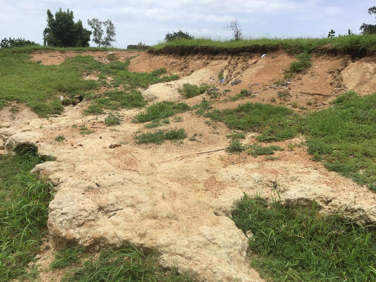
Land degradation (LD) encompasses the ongoing decline and loss of land productivity due to a combination of both natural and human-induced factors (UNCCD 2013). This pervasive issue holds global implications, impacting human communities and their sustenance. LD is defined as the progressive reduction in current and future land quality and output, stemming from either natural or anthropogenic influences (Beinroth et al 1994). Similar to numerous African nations, Ghana contends with heightened levels of LD. A staggering 35% of its land is under the threat of desertification, rendering it susceptible to the detriment of LD (UNCCD 2017). This distressing reality manifests in the depletion of grasslands, woodlands, and forests, coupled with the desiccation of natural water reservoirs due to extended droughts and the deposition of sediment. Archibald et al. (2010) disclosed that the Upper East region of Ghana, also among the most impoverished, bears the brunt of elevated LD. The fiscal impact of LD in Ghana is quantified at approximately USD 1.4 billion annually, equating to 6% of the nation's Gross Domestic Product (GDP) (UNCCD 2017). Hence, the exigency of addressing LD becomes evident. Effectively addressing LD within Ghana's sustainable intensification framework demands substantial resource allocation and long-term investments. These endeavors hold the potential to yield significant social benefits and enhance overall well-being. However, budgetary and human resource constraints necessitate the prioritization of these investments and interventions (von Braun et al., 2013).
In this context, spatial planning emerges as a pivotal element of sustainable intensification, hinging on access to LD area data. This information is pivotal in directing national budgets and crafting strategic interventions (Dubovyk et al., 2013). To this end, accurate LD hotspot maps for Ghana are indispensable. Beyond aiding in cost-effective guidance for focused ground-level studies, these maps also serve as a valuable resource for the pursuit of sustainable intensification.
Despite the importance of the LD problem in Ghana overall, and northern Ghana in particular, there have been only a few LD assessments in Ghana so far and they are largely inconsistent . Moreover, there have not been any assessments published in peer-reviewed literature to inform the SDG indicator 15.3.1 in Ghana. Several LD studies have been conducted without following the framework of the SDGs. Existing studies largely apply coarse spatial resolution remote sensing layers (>250m) that cannot capture the subtle changes in highly fragmented small-scale farms. This justifies the need for this study to fill an existing gap for LD research in Northern Ghana considering the SDG 15.3.1 indicator with geospatial tools, such as Remote Sensing and GIS.
Fieldwork
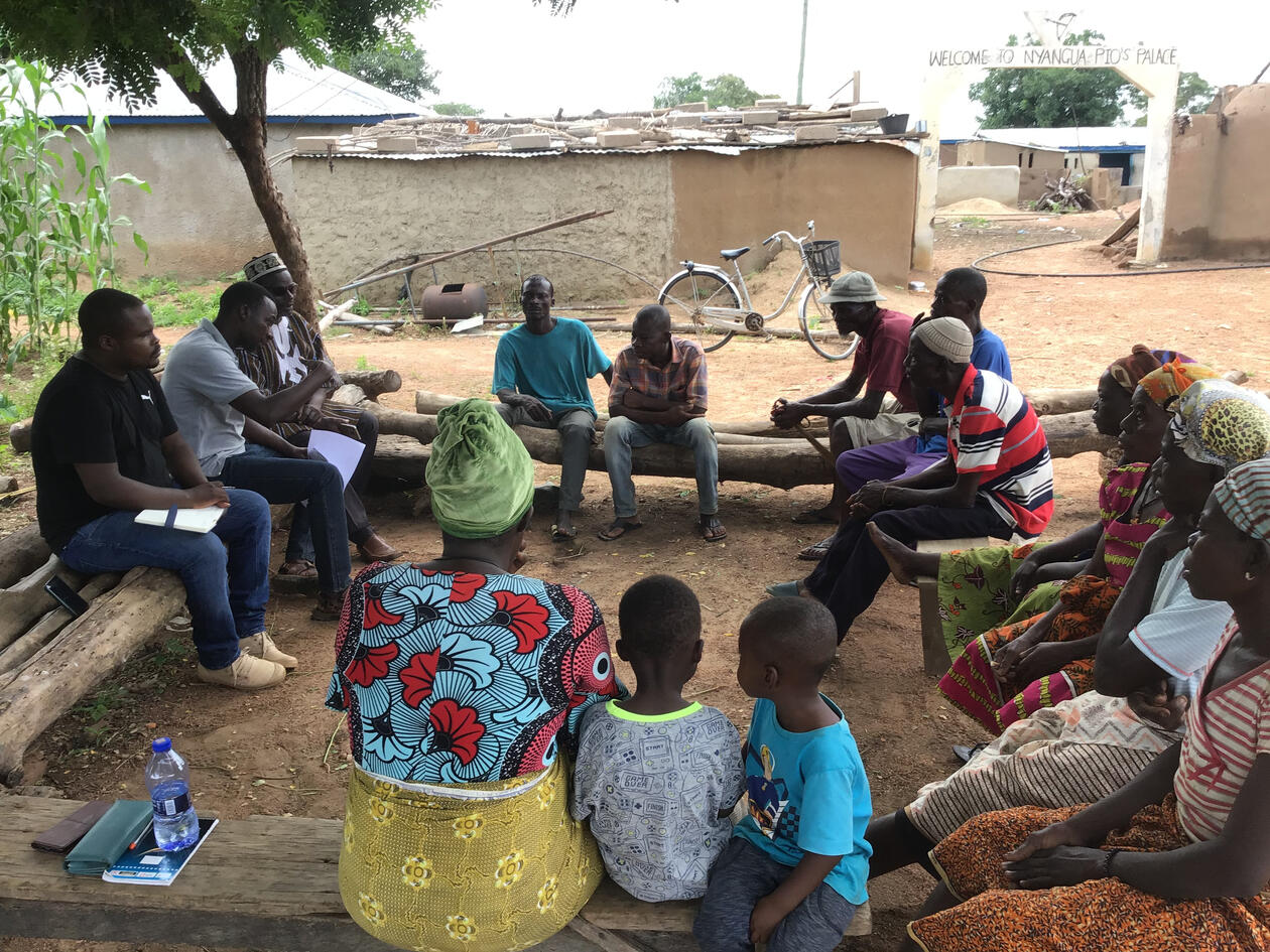
This study investigated the complex nature of land degradation in worse affected farming communities in the Northern and Upper East regions of Ghana. Fieldwork and ground truthing activities were conducted between 10th of August and 1st of August 2023 across 2 of the Northern Regions. Community truthing tools such as key informant interviews, focus group discussions, direct observation were employed as a means of soliciting societal responses integrated to conventional GIS spatial analysis. The fieldwork endeavered to achieve a tri-fold objective. Firstly, it aimed at aggregating secondary datasets relevant to the project. Additionally, it sought to gain nuanced insights into the landscape of LD, encompassing its status, underlying drivers, and causal factors. This endeavor was facilitated through informal dialogues with experts and farmers present in the field.
Moreover, the fieldwork direct observations, were strategically planned, adhering to a random sampling design.
Studying geography in Bergen
Studying Geography in Bergen is an exciting experience for me because of the way the program is structured. The possibility of fieldwork brings in a wealth of experience and builds strong networks for the students
UiB is the perfect place to consider for your studies, the University facilities, the methology for delivering lectures, the open door policy from the university staff and the contemporariness of the programs builds sustainability for future innovation to protect the environment while providing for future generations.
Gamuchirai J Mukura
- Student in Master in Geographies of Sustainable Development
- Writes his master's thesis about land degradation and the sustainable development goal 15.3.
- Supervisor: Olena Dubovyk
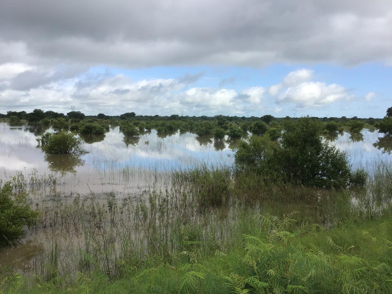
Photos from fieldwork: