Automated interpretation of deep sea imagery
This project has been allocated to the Master's student Marcos Tirados, who started his Master's studies in Earth Sciences, August 2021 at UiB.
Main content
Project description
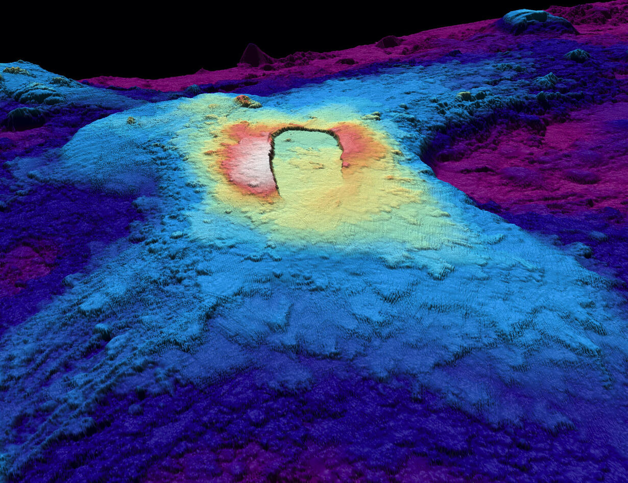
The majority of deep-sea mapping is conducted using expert-guided manual interpretation of acoustic imaging (e.g., sidescan sonar; synthetic aperture sonar) and bathymetric mapping (e.g. multibeam echosounder). As such the process if time-consuming and subjective. Advances in remote sensing and image classification techniques such as deep learning and object-based image analysis (OBIA) have helped automate the extraction of features from satellite images for robust and transferable mapping of landforms. These methods however have so far been underutilised in deep-sea studies.
This master student will seek to develop a method to automatically identify deep sea volcanic features and hydrothermal deposits. The proposed method would involve utilising deep learning (or convolutional neural networks) combined with OBIA in order to produce classified deep sea maps. The student will have access to the eCognition image classification suite with a range of image classification, and deep learning libraries built in and it is envisioned that the method would be adapted from outlined by Robson et al (2020) which was applied to rock glaciers.
Proposed course plan during the master's degree (60 ECTS):
GEOV316
The rest of the cpourse plan will be determined together with the student
Prerequisites
Experience with GIS is an advantage
Felt- lab- og analysearbeid
The main focus of the study involves using artificial intelligence (deep learning) to predict the locations of landforms on the sea floor. Deep learning works by recognising recurring patterns in data and is capable of identifying features that traditional remote sensing techniques cannot
Supervisors
Associate Professor Benjamin Robson, GEO, UiB
Professor Rolf Birger Pedersen, GEO, UiB
Dr. Thibaut Barryere, GEO, UiB