Recent morphological changes of Norwegian fjord deltas: Processes and controls
Main content
Project description
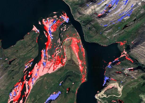
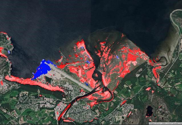
Norwegian fjord deltas are continously in change and prograding at variable rates, governed by amongst others catchment area and lithology, climate, basin depth, and anthropogenic factors. This master project will investigate morphological changes and progradation rates and their Controls of Norwegian fjord deltas, with focus on the last 35 years of satellite imagery.
The student will parameterize the temporal and spatial development of the fjord deltas applying a range of data sets (NGU bedrock maps, hydrology data, DEM, bathymetric data, etc). GIS software in combination with the Google Earth Engine platform will be used to process, correlate and illustrate the temporal and spatial development and their controls.
Proposed course plan during the master's degree (60 ECTS):
SDG213(10), GEOV229(10), GEOV300(5), GEOV302(10), GEO215/GEO316(10), GEOV360(10), GEOV364(5)
Prerequisites
Interest in statistics and basic knowledge in programming is recommended
External data
Databases in public domain
Field, Lab and analysis
Primarily desktop-work, using GIS software, Google Earth Engoine platform, and databases in Public domain. Field reconaissance and ground-truthing in a few selcted areas in western Norway
Supervisors
Dr. Bjørn Burr Nyberg (GEO, UiB)
Professor William Helland-Hansen (GEO, UiB)