Improving interpretation of 3D Ground-Penetrating Radar data in archaeology via attributes developed in seismic – application to selected Norwegian sites
Main content
Project description
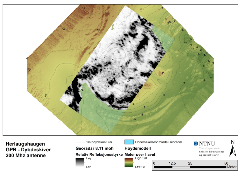
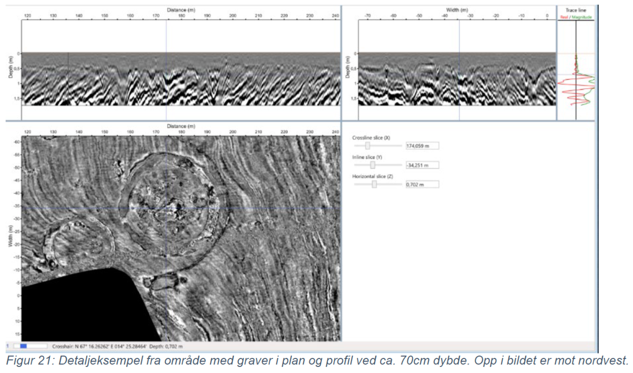
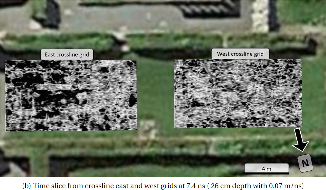
Ground-Penetrating Radar (GPR) is a geophysical method widely used in various near-surface applications, on Earth and other celestial objects (Moon, Mars, comets). GPR is especially well suited for archaeo-geophysics, as recently demonstrated in Norway at different sites, e.g., the Gjellestadskipet (see link below). 3D GPR acquisition for archaeology is often done in Norway with multi-channel systems mounted on a vehicle, so that large zones are rapidly mapped. The data are then often analysed in horizontal slices to identify potential archaeological structures such as burial mounds, viking ships, etc. Such 3D GPR data are more and more common, but they are mainly interpreted via a very few and classic amplitude attributes, e.g., the trace envelope.
The proposed project consists into extending the attributes use in GPR using known approaches and software in seismic, thus analyzing the portability of these attributes to GPR for better identification of archaeological structures from their surrounding geological setting. Existing and published dataset will be available, especially from burial mounds, but new – more targeted - dataset could also be acquired nearby Bergen with the available mono-channel equipment at GEO. Two students could especially co-operate in that case, in a dual geophysics-geology approach. An archaeo-geophysicist will provide existing 3D GPR data and co-supervise the work, while the seismic competence comes from GEO.
Gjellestadskipet: https://www.niku.no/prosjekter/jellestadskipet/
Proposed course plan during the master's degree (60 ECTS):
The course plan will be discussed with the prospective students depending on their background (geology or geophysics major) and specific interests in the proposed project.
Some courses are however strongly recommended, such as GEOV272 and GEOV300. A 5-ECTS special syllabus about GPR will be given, except if the candidate has already a solid background in that method from her/his previous studies. All courses related to seismic methods and data are of relevance.
Prerequisites
Prospective students should have a strong interest in either geophysics and its application in general, especially wave methods, or in reflection seismic and interpretation, the methods and software to be applied being used in seismic for O&G exploration.
External data
3D GPR data from NTNU (see illustrations and their reference)
Field- lab- and analysis
For working with existing data (NTNU and/or UiB), the work will be carried out in one of the two seismic labs to access the required seismic-based software (e.g., Petrel and similar).
Depending on the background of the student (i.e., geology or geophysics as major), local fieldwork could also be carried out, e.g., Lysekloster or burial mound near Fana, following a former MSc. project (Hansen, 2021), this to possibly study the impact of geophysical or geological parameters such as sampling, orientation of the survey, or soil-vs-object contrasts.
Supervisors
Professor Isabelle Lecomte, GEO, UiB
Arne Stamnes, Institutt for arkeologi og kulturhistorie, NTNU Vitenskapsmuseet, Trondheim
Dr. Leo Zijerveld, GEO, UiB